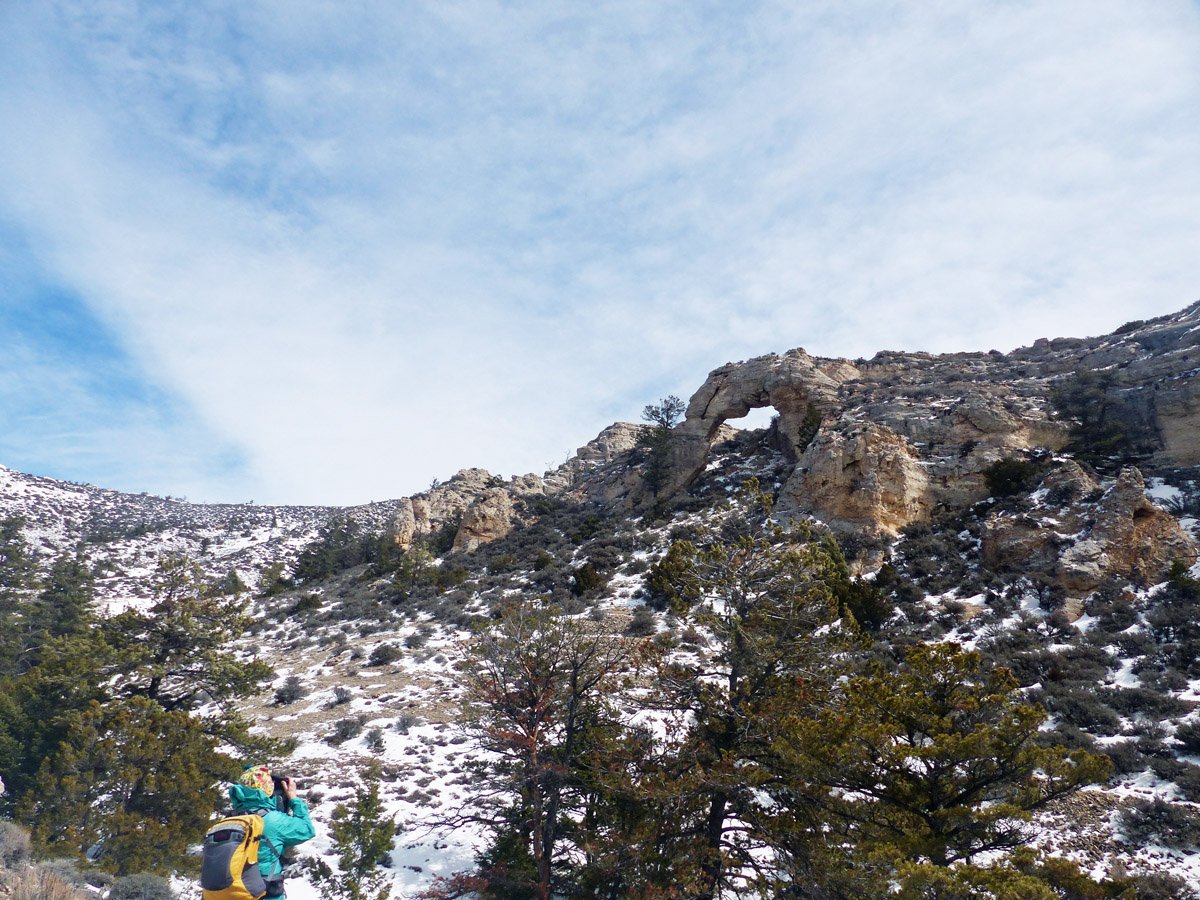
Sykes Arch from a distance. (dw photos)
Looking down canyon (east) on the return hike.

Margaret and mouth of the canyon.
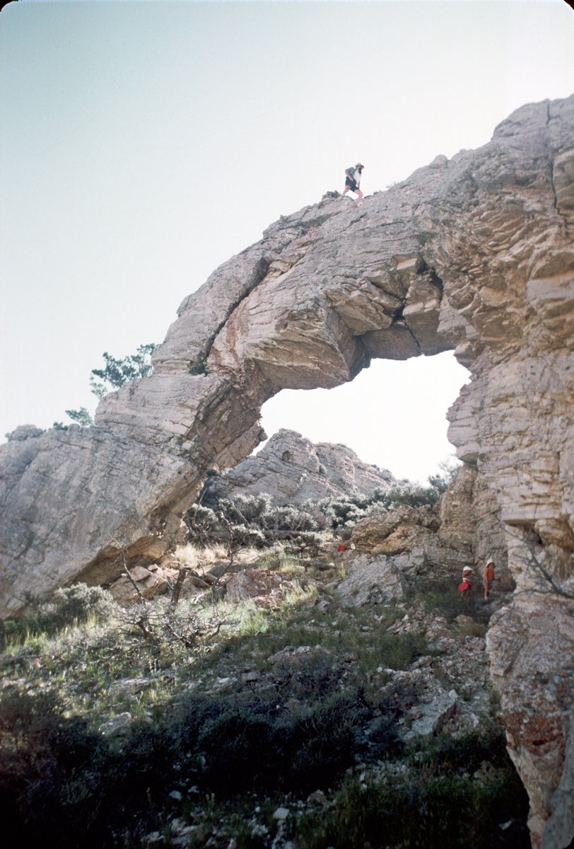
The Arch. Dave, Karen, and Dick in 1969.
Sykes Arch Hike
(May 2023)
The trailhead for this interesting hike is accessible with highway vehicles on paved Highway WY #37 in Bighorn Canyon National Recreation Area (BCNRA) about 18 miles northeast from Lovell Wyoming. The rock arch is a 5-mile (round trip) off-trail hike with 1,300 feet elevation gain. After a little more than ½ -mile the route leaves BCNRA and enters BLM for the remainder of the route. Half of the BCNRA route is designated as Recommended Wilderness. The entire BLM route is in BLM designated Wilderness Study area. We hope Congress will eventually designate this area, and much more in the Pryors, as Wilderness Area.
The Sykes Arch route was proposed to BLM by supporters of the Pryors Coalition. We are pleased that BLM, in collaboration with BCNRA, has designated this route in their 2021 Pryor Mountain Travel Management Plan. It may be awhile before BLM fully implements the designation of this route with a signed trailhead and marked route. Meanwhile this hiking guide should help you follow the route to the arch. BLM does not intend to construct a trailbed. The route will be marked, but off-trail for hikers only. Parts of the route follow wild/feral horse trails. In BLM’s 2021 Travel Management Environmental Assessment they write:
“The Sykes Arch trail would be managed solely for hiking use. This trail was envisioned to be marked with signs or cairns and would not be constructed except for specific areas where trail alignment would help concentrate hiking use to more appropriate locations. … This trail … would not be improved to the level that would allow equestrian passage. No mechanized use would be allowed.” (Appendix E, page E-29
Download a printable guide to Sykes Arch.
Getting There:
Detailed Maps and Driving Directions to Pryor Mountain hiking trailheads are available on the Hiking Overview page.
From the only stoplight in Lovell WY, follow Main Street (Hwy. 310) east ½ mile to the junction with Hwy 14A.
Turn left onto Hwy 14A at the junction. (The BCNRA Visitors’ Center is on the right in 0.1 mile.)
Drive 2.5 miles east on Hwy 14 to a brown “Bighorn Canyon National Recreation Area” sign at the junction with WY #37.
Turn left (north) on WY #37.
Drive 15 miles to the unsigned trailhead on the left (west) side of WY #37. A quarter mile before the trailhead several powerlines cross the paved road. The trailhead is 50 yards past a cattleguard. Immediately after the trailhead the road curves right back under the powerlines. Park on the gravel. (The trailhead is 0.2 mile before (south of) the right turn to Devils Canyon Overlook.)
Park west of Hwy WY #37 just north of cattleguard.
The Hike:
0.0 miles: Trailhead. Follow a (closed to motor vehicles) gravel road about 0.1 mile west until it turns left (south). Continue west off-trail across the brushy flat toward the canyon. This is a hiking “route,” not a trail. Eventually BCNRA may designate the route more explicitly with trail signs or cairns, but they do not plan to construct a trailbed to follow.
0.3 miles: Cross shallow north-south drainage and enter the narrow, rocky and winding canyon heading northwest. This is now BCNRA Recommended Wilderness.
The brushy flat, and the canyon.
Sykes Arch Hike Route – yellow line
Expanded view of flat grassland gap and two-track.
0.6 miles: Pass a large north fork of the canyon. Continue west in the now wider main fork.
0.8 miles: Leave BCNRA Recommended Wilderness Area and enter BLM Wilderness Study Area. This north-south boundary is not marked on the ground. Continue up the sometimes rocky and brushy canyon bottom heading mostly west. Farther on the canyon widens and flattens, and then curves toward the north.
When the drainage begins heading mostly north, go west out of the brush and trees onto a flat open grassland. Look for an approximately 200 ft wide flat grassland gap between hills to the south and north. A two-track from (4WD only) Sykes Ridge Rd. passes through this gap heading NE. (The infrequently used two-track was for administrative use only. 2021 travel planning documents indicate that is is no longer authorized even for administrative use.) Intersect this two-track near the base of the hill at the north of the flat, open and grassy gap.
1.5 miles: Intersect two-track Rd. at the base of the north hill. Follow the two-track to the right (NE). East of the north hill it turns north paralleling the drainage you recently left. In about 0.2 miles the two-track ends at a water catchment and guzzler built for the wild/feral horses.
The two-track heading NE toward guzzler
Water Catchment and Guzzler
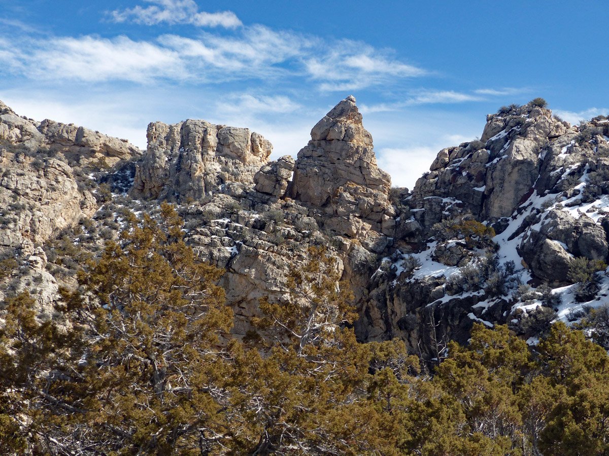
1.7 miles: Guzzler. From the water catchment and guzzler follow horse trails east a bit around the base of a hill, then curve north following the main drainage on your choice of intermittent, intersecting horse trails. There are several side drainages and rocky prominences to the east, but continue north as the canyon bottom narrows with steeper sides. It is about 0.8 miles from the guzzler to the arch. Stay near the bottom of the drainage below the rocky cliffs to the west. The arch is on the right (east) side of the drainage, but the last part may be easier walking on the slope west of the drainage. From there the arch can be seen high on the opposite (east) side, and a route up to it can be selected.
2.5 miles: Sykes Arch
Horse trail. Turn left around base of hill following the drainage north with the two rocky prominences to the east and rocky cliffs to the west.
Looking across the drainage to Sykes Arch.