Cave Ridge Hike

Cave Ridge (dw photo)

View of Big Pryor Mountain from south end of Cave Ridge (dw photo)
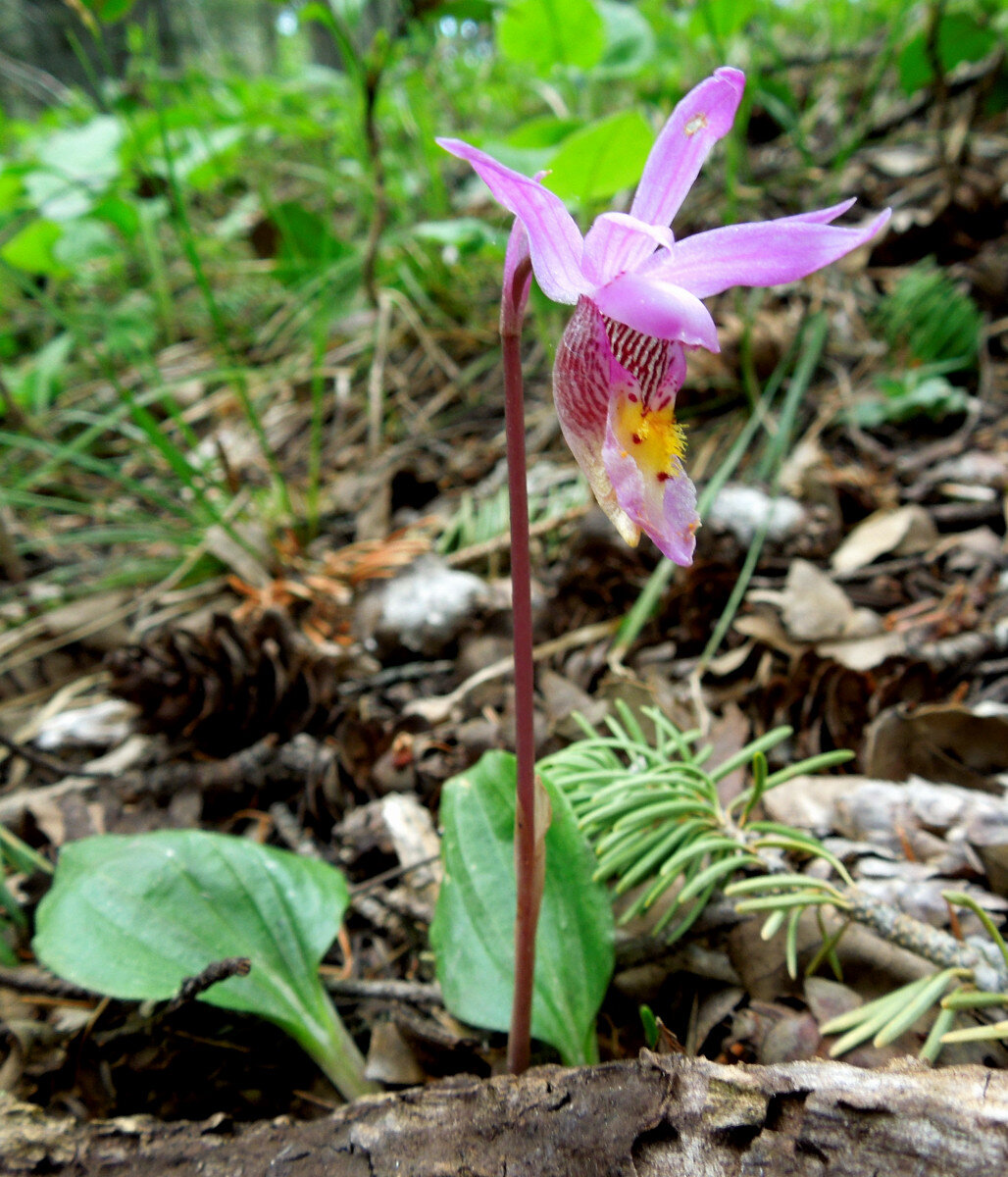
Calypso Orchid or Fairy Slipper, Calypso bulbosa (Quetchenbach photo)
Cave Ridge is a good hike anytime the weather and road conditions allow vehicle access to Big Ice Cave. It is also a good hike for families and children, or for anyone who wants a leisurely walk. The Cave Ridge Loop is particularly good in June and early July when the wildflowers can be spectacular. We have identified as many as 30 or 40 species of flowers on a single June day.
The loop hike is about three miles and includes about 600 feet elevation gain on the return trip. Just over half the hike is off-trail. However route finding is not hard without a marked trail. The Hiking Directions below should be adequate. We hope there will be a Forest Service designated trail in the future.
Download Cave Ridge Hike Guide
Getting There:
Detailed Maps and Driving Directions to Pryor Mountain hiking trailheads are available on the Hiking Overview page.
From Highway #310 south of Bridger follow the Pryor Mountain Road driving directions 34.4 miles to Big Ice Cave at point “I” on the Pryor Mountain Road map. Park in the Big Ice Cave parking area. There are picnic tables and a pit toilet, but no water. Note: Pryor Mountain Road (#2308) is seasonally closed with a barricade at Crooked Creek Rd (mile 30) until May 22 each year.
Cave Ridge Hiking Loop Directions:
1. Start from the Big Ice Cave parking area and picnic tables.
(An alternative is to start where the old logging road (not open for motorized use) leaves Pryor Mountain Road about 0.4 miles northwest of Big Ice Cave picnic area. Simply follow the abandoned road bed south to point 3 on the hike map below.)
2. From the picnic area walk west or southwest about 1/3 to 1/2 mile to an old logging road.. The precise direction doesn’t matter. There is no trail. The route begins down a gentle slope through open forest, then enters one of several large clearings from 50 year old clearcuts. The old road is perpendicular to the west or southwest path from the picnic area. Natural vegetation is returning to the abandoned road surface, but the shape of the originally constructed road is still obvious.
3. Turn left (south) on the abandoned road. It is not open for motorized use.
4. Follow the old road about a mile to its end at the upper (NW) end of an old clearcut.
(Shorter variations of the hike are easily possible. From any point on the old road turn east, uphill until you arrive at the rim of Cave Canyon. Then follow the rim north back to Big Ice Cave picnic area. See point 6 below.)
5. From the “road” end walk southwest about 300 yards down through the clearcut to the rocky canyon edge. Then follow the cliff edge south and east through the trees to the southern tip of Cave Ridge where the deep canyon east of Cave Ridge converge with Cave Canyon to the west. This is a good lunch stop. Further south Cave Canyon converges with Lost Water Canyon. West across Island and Commissary Ridges Big Pryor Mountain is visible.
6. When ready to return from the view point, follow the rim of Cave Canyon east at first then curving north back to Big Ice Cave picnic area. Again there is no trail. Keep the canyon in sight to your right and follow the ridge north. Big Ice Cave picnic area is right on the canyon edge so you can’t miss it. Along the way there are several rocky points overlooking the canyon. Some of them have coral and brachiopod (clam-like shell) fossils from when this limestone was the bottom of an inland sea some 350 million years ago.