Petroglyph Canyon Hike
Scenic Petroglyph Canyon is an interesting hike even without the Petroglyphs. In addition the hike provides access to view Rock Art created a thousand or more years ago by early residents of the Pryor Mountains. This is a very sensitive area, formally designated by BLM as an “Area of Critical Environmental Concern” (ACEC)
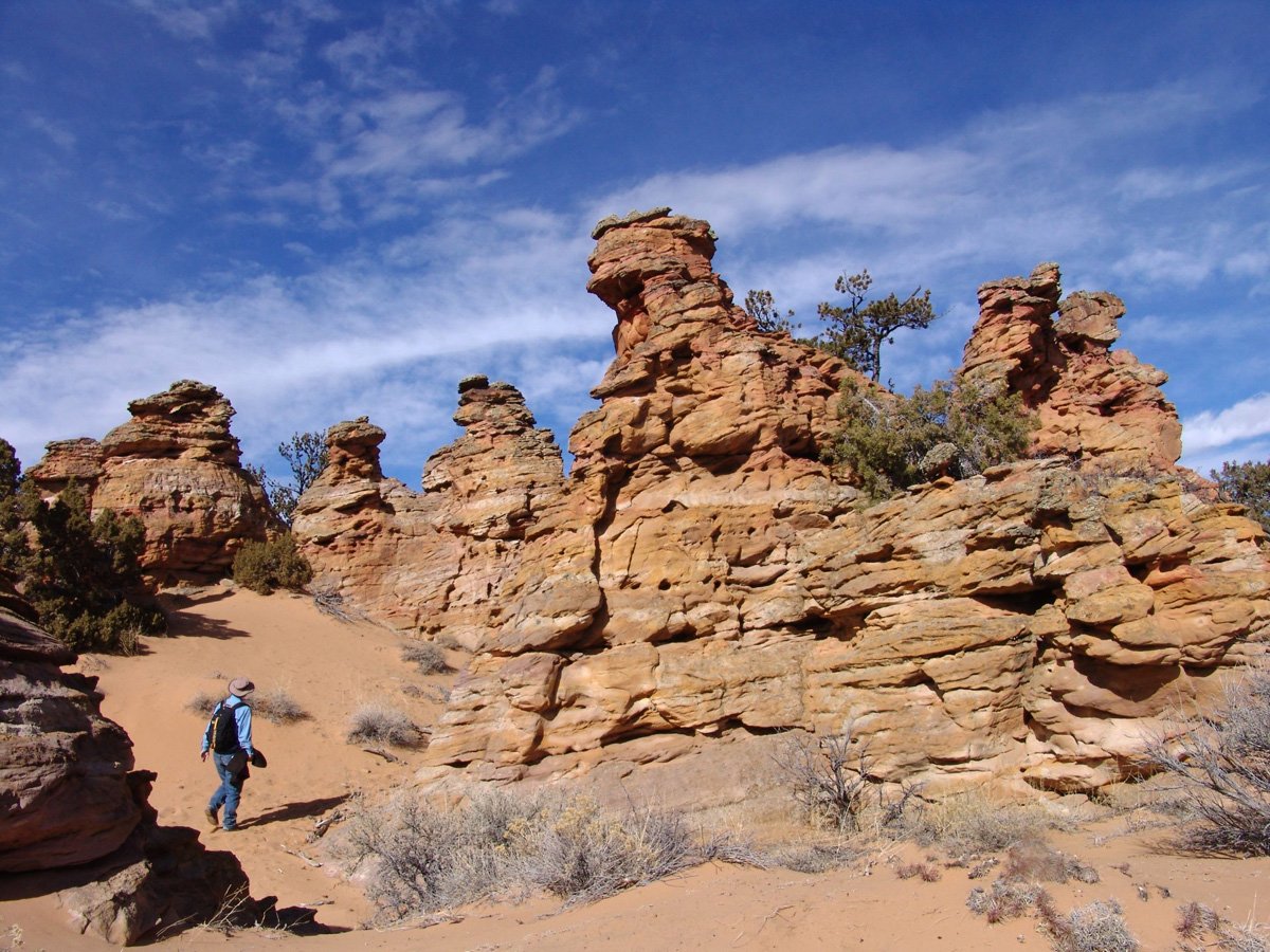
Ginny Waples photo
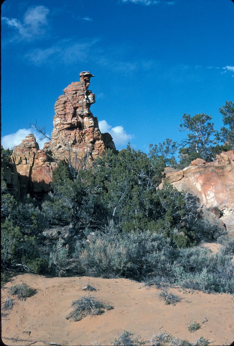
Dick Walton photo
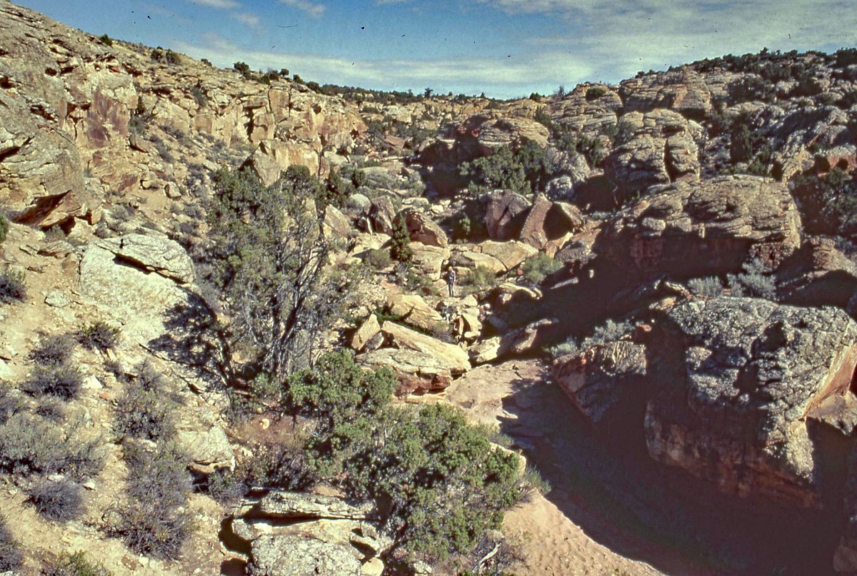
Dick Walton photo
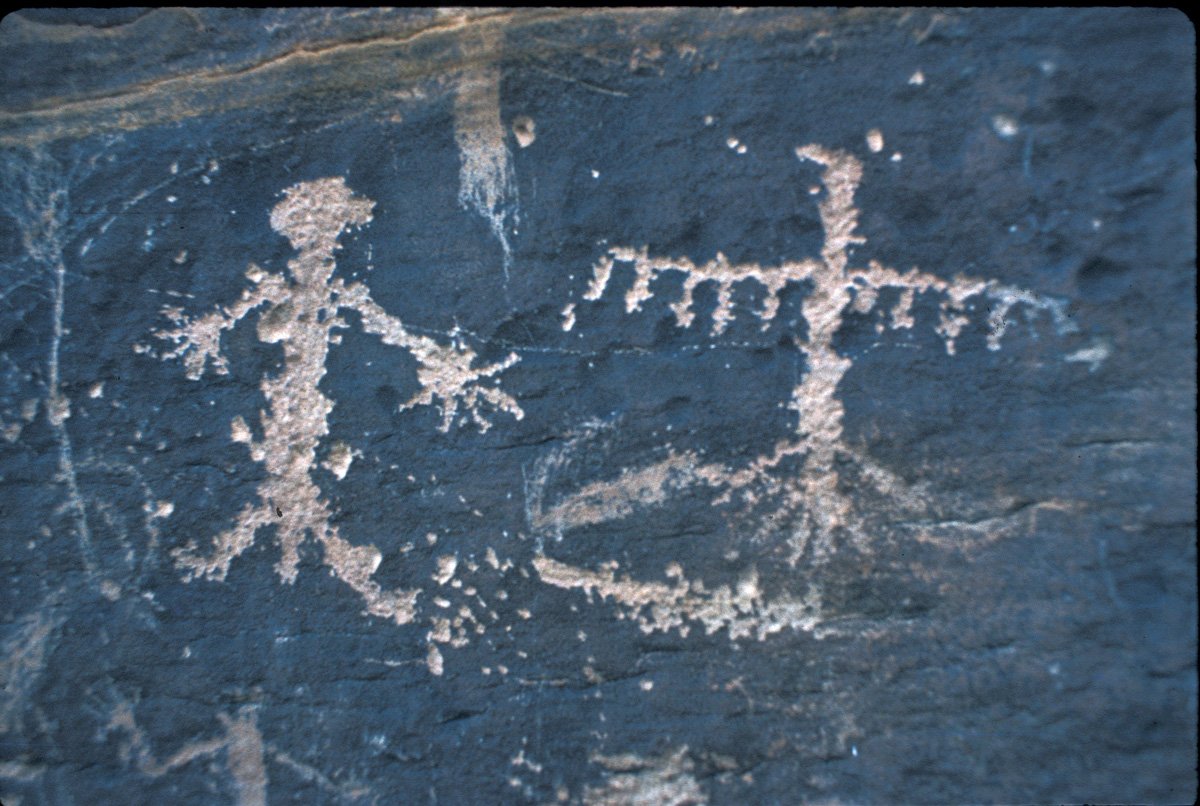
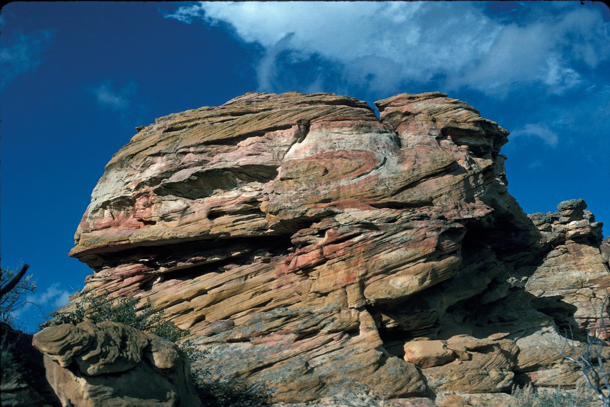
Larry Loendorf photo
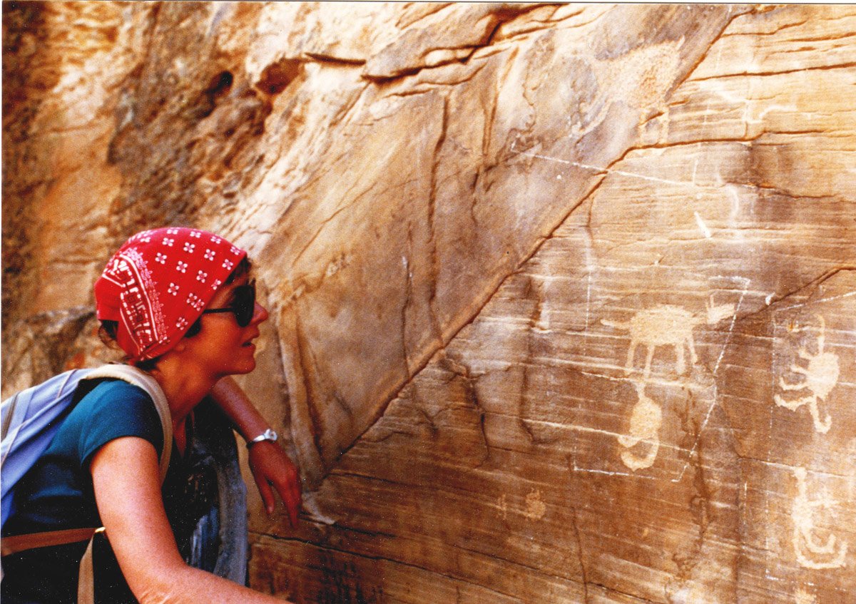
Liz in the canyon. (Dick Walton photo)
Dick Walton photo
Ginny Waples photo
Ginny Waples photo
“Archaeological sites on federal lands are protected by a three or four different laws and unlike the weak protection in the 1960’s, today’s laws have severe penalties and law enforcement officers for the Crow Indian Tribe, the Bureau of Land Management, the National Park Service and the Forest Service are trained in catching pothunters. Many sites are protected by hidden cameras that begin filming when people arrive, so be aware and report suspicious activity to the appropriate land managing agency.” - Larry Loendorf, Archaeologist
“A lot is still unknown about the origin and intention of the rock art in this area. Preserving these petroglyphs is critical to protect our link to the past. Look but please do not touch the petroglyphs! Vandalizing rock art is illegal, punishable by fines as high as $100,000, and imprisonment as long as 5 years, or both.” - Bureau of Land Management
Download a printable Petroglyph Canyon Hiking Guide.
Go to Larry Loendorf’s discussion of the Petroglyphs of Petroglyph Canyon.
Getting There:
Detailed Maps and Driving Directions to Pryor Mountain hiking trailheads are available on the Hiking Overview page.
From Warren MT:
Drive to Warren MT, 21 miles south of Bridger, on Highway 310. Look for the Montana Limestone Company sign. There is no “town” at Warren. Warren is where limestone from the quarry at the southwest corner of Big Pryor Mountain is loaded onto railroad cars.
Turn east on Helt Rd (also called Quarry Rd.).
Follow this paved road for 2.7 miles to a junction and road sign. The BLM sign on the right fork says, “Stockman Trail 1.5” and “Bear Canyon Road 3.5”. The paved road curves left as Quarry Rd.
Continue straight on Helt Rd, which is now narrower and gravel. Go past BLM signs for Graham Trail, Stockman Trail and Bear Canyon Rd.
Follow gravel Helt Rd 4.4 miles from the pavement (7.1 miles from Highway 310) to a “Y” junction and cattle guard. Take the right fork, which is Gyp Springs Rd. (The left fork is Helt Rd.)
Follow Gyp Springs 3.5 miles to a fence and cattleguard.
0.0 miles: Immediately past the cattleguard, turn right (south) off of Gyp Springs Rd. onto an unsigned (as of September 2022) road. This is the road to Petroglyph Canyon. (From here the directions below generally follow the most obvious road.)
0.25 miles: there is a second cattleguard with large tractor tires on the sides. Turn right (west) through the cattleguard. The road soon turns left (southwest) toward a distinctive hill in the otherwise mostly flat landscape.
~ 1 mile the road passes just east of the hill.
1.6 miles: A BLM kiosk with information about Petroglyph Canyon, and the Petroglyph Trailhead.
The final section of this access route has some rough, rocky places that may challenge some highway vehicles. Some drivers may park and walk the final quarter mile or so to the trailhead.
(Google Earth marks a “Petroglyph Canyon Trailhead” at the lower (south) end of the rocky canyon. This is NOT the best access point described above. That point is only accessible by crossing private land and on two-track roads not open to the public.)
The Hike:
There is no constructed trail. BLM states in its Pryors Travel Plan: “a designed, delineated trail tread does not exist.” Appropriately BLM will not construct a trail. Only hiking is permitted. The route is not suitable for equestrians, mountain bikes or motorized vehicles.
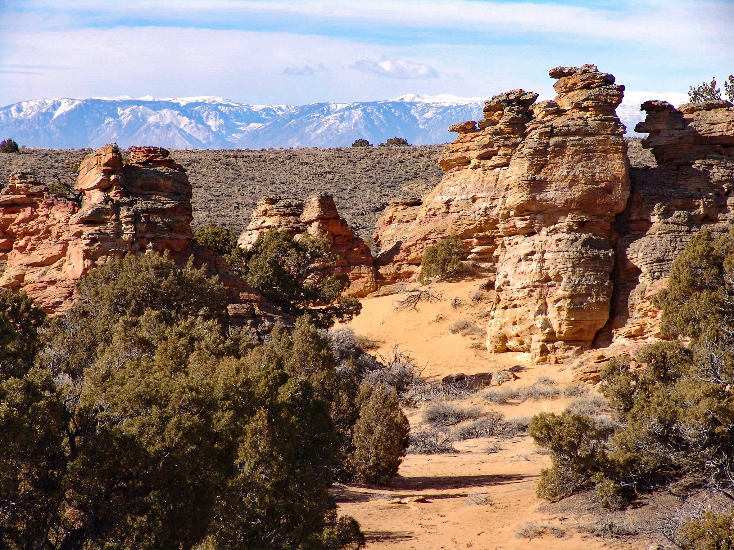
From the trailhead walk southwest over sand dunes and through fascinating rock formations. It is about ¼ mile and 80 feet elevation down to the canyon bottom. Turn left (southish) and follow the canyon downstream (usually dry). The hike is about one mile (one-way) and about 250 feet elevation drop from the parking area to the end of the rocky cliffs and boulders in the canyon. There are no signs directing hikers to the petroglyphs. Look for them on the rocky canyon walls and on some large boulders. Do not stay in the very bottom. Look on canyon walls behind large boulders.
Return to Hiking Overview
The Petroglyphs
This is an edited excerpt from Larry Loendorf’s discussion of the Petroglyphs of Petroglyph Canyon. Loendorf, an archaeologist, has done considerable research in the Pryors including inPetroglyph Canyon.
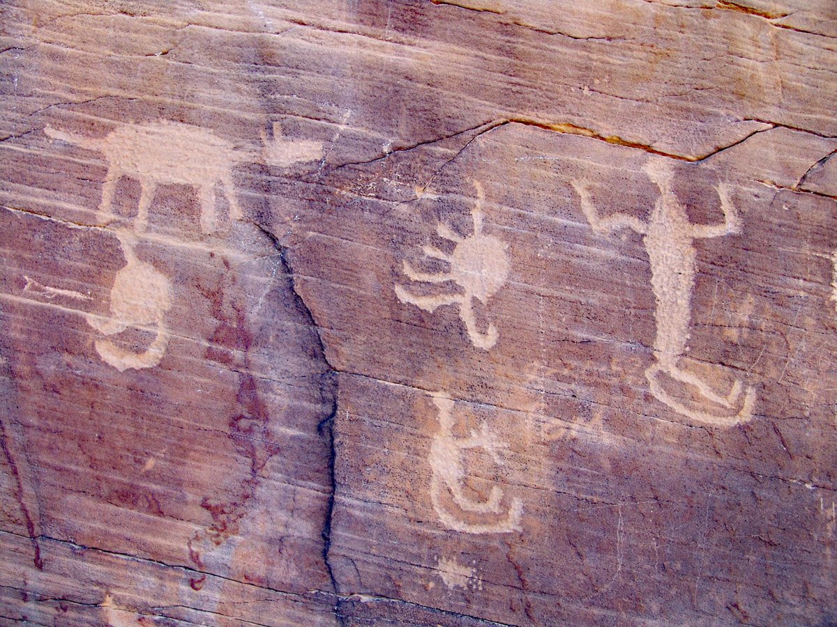
Petroglyph Canyon contains a distinctive type of petroglyphs that are made by totally pecking out the bodies of the figures. This type is called the En Toto Pecked (ETP) style.
ETP petroglyphs are dominated by full facing human figures or anthropomorphs, often in rows that include males and females. Although they are uncommon, some ETP anthropomorphs are depicted in profile views. There are also some made by incising or scratching out the form of the anthropomorph. Incised lines are often shown protruding from the hands, feet, and heads of the full-facing anthropomorphs with some head embellishment as incised line crown-like forms.
In addition to the rayed lines, the most complete ETP anthropomorphs have toes and fingers, and exaggerated sexual organs. Male and female genitals are oversized to the point where they dominate the figures.
Non-human animals include ungulates, canids, birds, and possible insects. Many quadrupeds are simple with little embellishment. On the other hand, there are some, like bison, that are good likenesses of the animal they are portraying. Short-pointed horns are found on some quadrupeds but there are no branching antlers. Bighorn sheep that are recognizable with horns swept back over their bodies, are known, but very rare.
It should be clear that no petroglyphs have been directly dated. However, the radiocarbon ages from test excuvations let us know that people inhabited Petroglyph Canyon for 1000 years between 1820 and 850 years before the present.