Rocky Juniper Trail
Revised 6/30/2024
The Rocky Juniper Trail enters the mouth of a rocky canyon and climbs into a valley between scenic rocky cliffs with abundant Utah Juniper. This is the northern limit of the range of Utah Juniper (Juniperus osteosperma). Most juniper in the rest of the Pryors (and Montana) is Rocky Mountain Juniper (Juniperus scopulorum). This route, within the Montana Audubon designated Bear Canyon Important Bird Area (IBA), is good habitat for a variety of birds ranging from prairie falcons to pinion jays. (See link to more information at www.PryorMountains.org.)
0.9 mile from the trailhead the hike crosses a Saddle with a panoramic view of the slopes of Red Pryor and Big Pryor Mountains to the east and north. About a half-mile beyond the Saddle the hike reaches the Forest Service designated Bear Canyon Recommended Wilderness Area (RWA). Most of the view north and west from the Saddle is in the RWA.

Why is it named the Rocky Juniper Trail?

View NE of Bear Canyon RWA from the Saddle. (d. walton photos)

Looking north from the hill near the BLM / FS boundary. From The Junction the Big Sky Trail goes to the left of the hill and curves to the right behind it.

Bear Canyon looking south. The FS/BLM boundary fence is on the hillside in the upper left.
The 2021 BLM Travel Plan for the Pryors officially designated the Rocky Juniper Trail. It is designated for foot travel only (human and horse). Mountain bikes and motorized vehicles are not permitted.
In 2022 BLM placed “Trail” signs at the trailhead and key points along the route, and made a much-easier-to-follow trailbed. They included an 0.4 mile shortcut between the Rocky Juniper and Big Sky Trails just south of the BLM/USFS boundary fence. This makes a 3.7 mile loop hike (including 0.9 miles of Horse Haven Road between the Rocky Juniper and Big Sky trailheads). Bear Canyon cannot be seen from this loop.
The longer 5.4 mile loop hike with Big Sky Trail extends farther north into the USFS managed Bear Canyon Wilderness Area with spectacular views of Bear Canyon. A loop hike with the Bear Canyon Trail is also an option.
The USFS trails are not officially designated or signed by Custer Gallatin National Forest. We hope they will be someday soon.
Download a printable Rocky Juniper Trail Guide.
Rocky Juniper Trail Area Map. (Mileages in white.)
Getting there:
Detailed Maps and Driving Directions to Pryor Mountain hiking trailheads are available on the Hiking Overview page.
The Rocky Juniper Trailhead is on a short spur road north from Horse Haven Road 0.9 miles from Helt Road. Both the spur and the trailhead have “Rocky Juniper Trailhead” signs.
Sign at 0.9 mile junction on Horse Haven Rd.
Rocky Juniper Trailhead
The Trail:
0.0 mile: Trailhead (5,250 ft.). A couple hundred yards beyond the trailhead barricade the track turns left (west) into a dry drainage. Then about a hundred yards farther the route turns right (north) again. The first 1⁄4 mile, long ago a “road”, is steep uphill and very rocky.
0.3 mile: Gentler Trail. In another one or two hundred yards the route climbs out of the canyon onto flatter terrain and continues north between parallel ridges of rocky hills to the east and west. The trail and signs lead to the saddle marked with the black arrow in the photo below.
0.9 miles: “The Saddle” (5.660 ft.). The rocky ridge on the right (east) ends with a final rocky point. The rocky ridge on the left (west) continues another half-mile north. An expansive view of Big Pryor Mountain opens to the north and east. The well signed and cleared trail (in 2024) continues northward from the saddle. Look back at the saddle from the north so you know where to go on the return hike. (See photo.)
The route turns right (north) and is steep uphill and very rocky.
The Saddle
1.4 mile: “The Rock” and BLM / USFS Boundary Fence (5,630 ft.). About 1/2 mile north of the saddle the trail leads to a large, isolated limestone boulder (about 8 feet “diameter”). See photo. This boulder is a useful landmark.
The Rock
The Rock and trails o the Triple Junction, the Rocky Juniper Saddle, and the Shortcut to the Big Sky Trail.
There are two options for continuing beyond The Rock:
The Short Option: The signed BLM shortcut trail goes east about 0.4 miles past the Rock to the Big Sky Trail. Part of this trail is single-track. Part is an old unused two- track. Turn right (south) on the Big Sky Trail 1.0 mile to the Big Sky Trailhead on Horse Haven Road. It is another 0.9 miles on Horse Haven Rd back to the Rocky Juniper Trailhead – 3.7 miles total for the loop.
The Shortcut
The Long Option: This route continues north into the Bear Canyon Recommended Wilderness Area. There are no trail signs on these not-yet-designated USFS routes. The east-west BLM / USFS boundary fence is a few yards north of The Rock. Follow the fence west for about 100 yards to a junction of fences: 1. the fence west from The Rock. 2. a perpendicular fence heading south, and 3. a fence heading northwest.
Follow the fence northwest for another 100 yards until it breaks out of the trees. Then turn north, downhill a couple hundred yards to the unmarked Triple Junction near the edge of Bear Canyon.
The route west along the fence from The Rock. Note the fence post near the center of the photo.
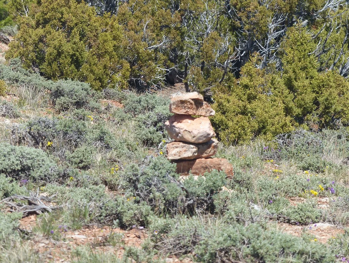
Bear Canyon Trail cairn near The Junction (2024)
1.6 miles: Triple Junction or “The Junction.” (GPS coordinates: about 45.0909°N, 108.5142°W.) The Rocky Juniper, Big Sky, and Bear Canyon Trails converge at this junction. There are no trail signs, and no trails at The Junction. Perhaps someday Custer Gallatin National Forest will fix that to better accommodate hikers in the Pryors. In 2024 there was a small rock cairn near where the route descends into Bear Canyon.
Looking north to the Triple Junction from near the BLM / FS boundary fence on the rocky topped hill to the south.
The turquoise arrows indicate the Big Sky Trail north and to the left (west) of the hill. It then turns right (east) behind the hill along the rim of Bear Canyon. The yellow arrow indicates switchback trail down to Bear Canyon Creek Trail.

The switchback trail climbing out of Bear Canyon is visible beside white arrows.
Return Hike:
Return the way you came, or consider two loop hike alternatives. You can return hike via either the Big Sky or Bear Canyon Trails. For more loop hike directions see Bear Canyon and Hikers Haven Area Loop Hikes.
How to find the three trails from the Triple Junction:
Rocky Juniper Trail: From the triple junction walk south uphill to the fence and follow it east to The Rock.
Bear Canyon Trail: From rock cairn at the edge of the junipers near The Junction walk roughly north down into the canyon to find the trail and switchbacks. See Google Earth view of the Bear Canyon Trail switchbacks.
Big Sky Trail: From The Junction walk mostly north between the canyon (on the west) and the hill (on the east). See photo above. The route continues around north of the hill and east along the rim of the main (east) fork of Bear Canyon. (See the Big Sky Trail Guide and maps.)