Bear Canyon Trails
Bear Canyon Creek Trail and Bear Canyon Ridge Trail
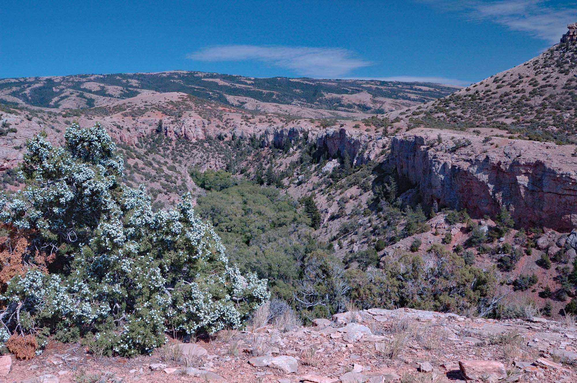
View from lower Bear Canyon

West Fork Bear Canyon and Big Pryor Mountain from the Ridge Trail.

Rose Hips and Sage. (d.walton photos)

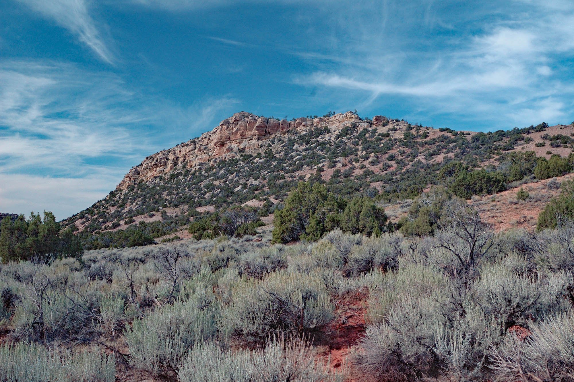
View SE across lower Bear Canyon from the Ridge Trail.
Juniper berries and lower Bear Canyon from Ridge viewpoint.

Looking upstream from the Creek Trail. Main fork to right. West fork to left.
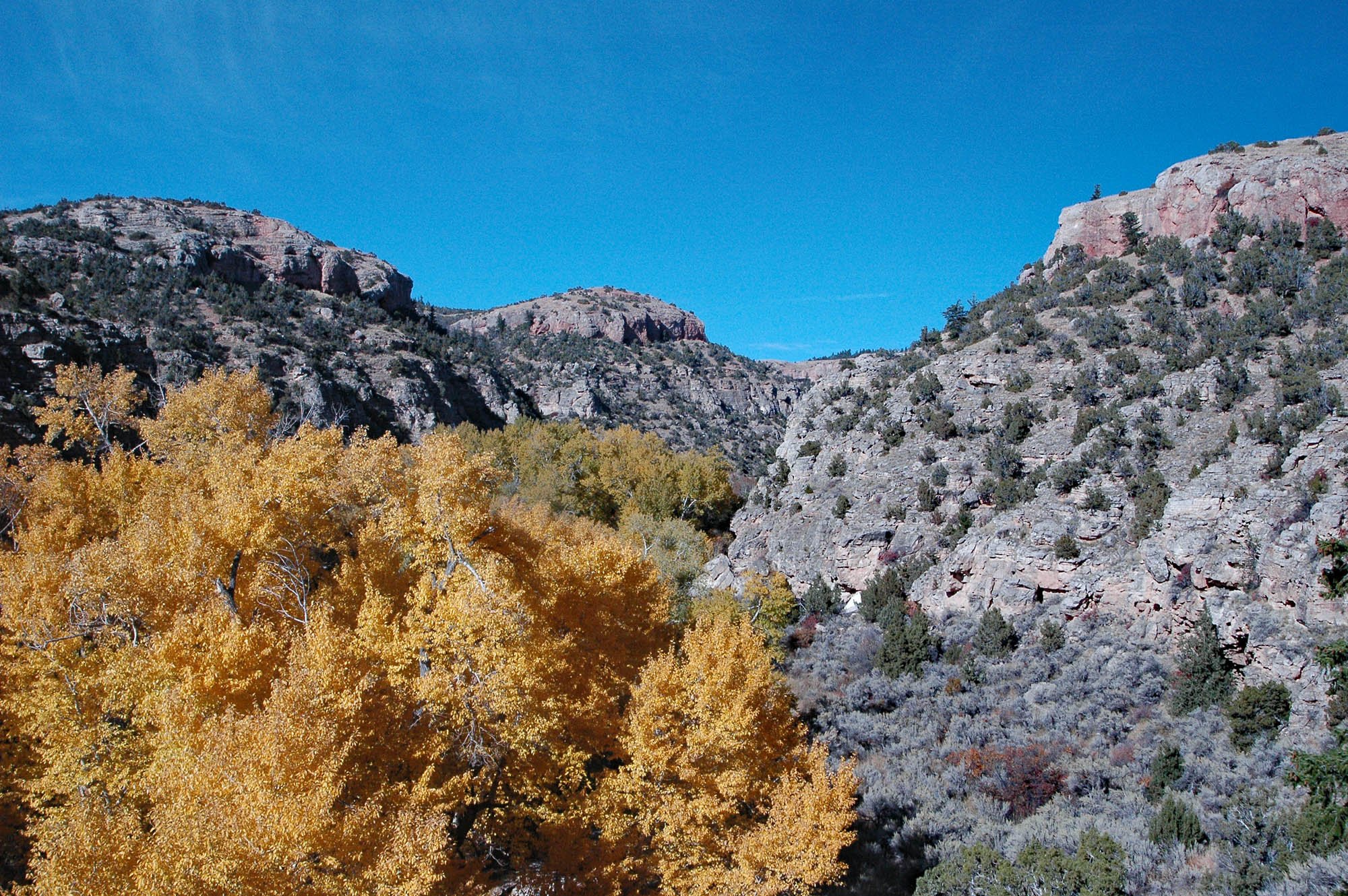
Fall Aspens in Bear Canyon from the Switchback Trail.

Jennifer hiking the Bear Canyon Creek Trail.
Download printable Bear Canyon Hike Guide
Bear Canyon includes a riparian oasis in the arid south Pryors - the driest area in Montana. Bear Creek runs in spring and early summer. It can be a torrent if there is a cloudburst upstream. The canyon is a favorite for bird watchers. The first three miles of the hike is within the Montana Audubon Society designated Important Bird Area (IBA).
Like the nearby Hikers’ Haven hikes, Bear Canyon is a good place to hike in the spring and fall when other Montana trails may be snowed in. And the scenery is great.
Access to these two hikes only requires driving four miles off paved roads. The good gravel road is passable most of the year. Neither a high clearance vehicle nor 4WD is needed. The drive from Billings MT to the mouth of Bear Canyon takes about 1 ½ hour.
Detailed Maps and Driving Directions to Pryor Mountain hiking trailheads are available on the Hiking Overview page.

Driving Directions:
Drive to Warren MT, 21 miles south of Bridger MT on Highway 310. (It is 20 miles south of the junction of highways 310 and 72 from Belfry and Red Lodge MT.)
There is no “town” at Warren. Look for the Montana Limestone Company sign. Warren is where limestone from the quarry at the southwest corner of Big Pryor Mountain is loaded onto the railroad cars.
At Warren turn east onto Helt (or Quarry) Rd. Follow the pavement 2.7 miles. Paved Quarry Rd curves left. Instead go straight (NE) on Helt Rd., now narrower and gravel. Drive 3.5 miles from the pavement on Helt road to a “Bear Canyo Road” sign. Turn left foe ½ mile to the mouth of Bear Canyon.
It is possible to drive farther into the canyon, but few people would want to take highway vehicles over the several very rough rocky sections. You came to hike.

Highway 310 approaching Warren MT from the north. Helt Rd is the left turn just before the buildings.

Helt Road sign where it leaves paved Quarry Road

Bear Canyon Rd: Left turn from Helt Rd.
The Ridge Hike (purple) is also 4WD legal. Click to enlarge.
The Bear Canyon Creek and Ridge Hikes:
A. 0.0 miles: Mouth of Bear Canyon. The Pryor Mountains suddenly rise from the plains ½ mile from Helt Road on Bear Canyon Road. Start walking on the 4WD road into the canyon. All hiking mileages below are measured from the canyon mouth. There is no trail sign at the beginning of the hike which is on Bureau of Land Management (BLM) managed land.
For the first 1.4 miles the trail follows the broad sagebrush flat in Bear Creek Valley, bordered by cliffy limestone ridges vegetated with juniper and bunch grass. The elevation gain on this section is only about 250 ft.
If you meet people on ATVs or driving 4WD vehicles, please be courteous. This route is currently legal for motorized use. Although this segment of the hike is legal for motorized use, we recommend you park and walk from the canyon mouth even if you have a 4WD. The road is rough, and you came to hike. There is an abundance of other motorized routes up Big Pryor Mountain BLM and the Forest Service should serve hikers by designating abundant quiet hiking trails in the Pryors.

B. 1.4 miles: A Junction:
The left fork starts climbing steeply out of the canyon. This is the Bear Canyon Ridge Hike.
The right fork enters the narrowing canyon bottom. This is the Bear Canyon Creek Hike.
Bear Canyon Ridge Hike (Left fork at junction)
This route is legal for motorized use, but is also a good hike with great views of Bear Canyon, the Beartooth Mountains, and Wyoming. (Avoid weekends and holidays if possible.). The entire round-trip hike from the mouth of Bear Canyon, including the 3-mile loop on the end (shown in purple on the map), is about 10 miles and 1,700 feet elevation gain. It can be shortened by cutting across the loop wherever desired. (e.g. red line on map).
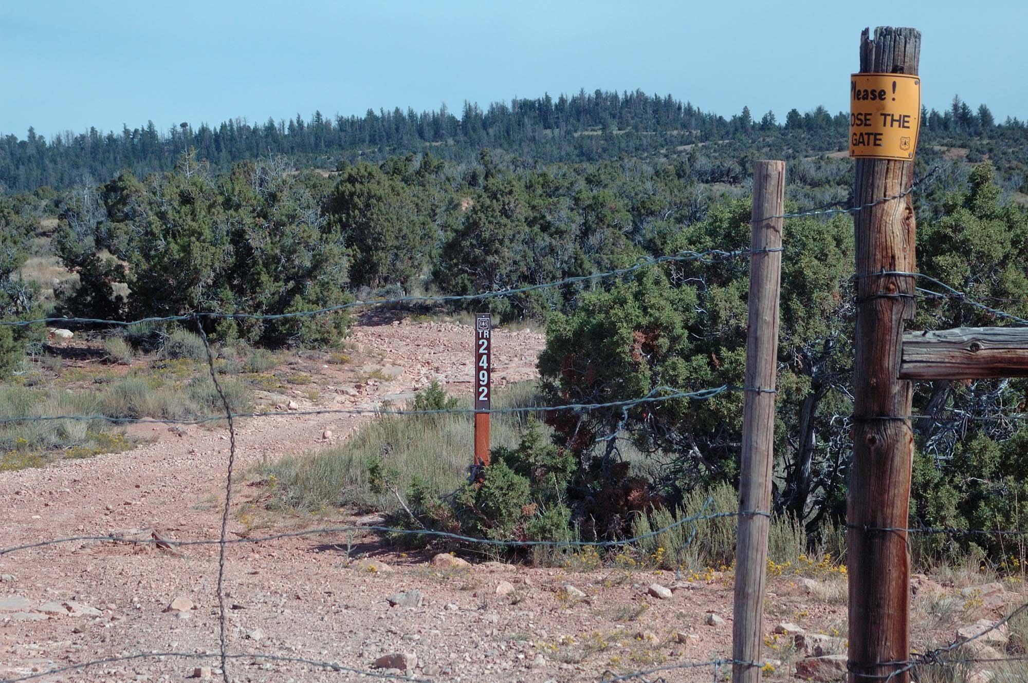
C. 1.9 miles: Fence and Gate. At this boundary you leave BLM land and enter Custer Gallatin National Forest. There is a sign indicating that this is USFS Trail # 2492.
D. 2.1 miles: Junction. Trail #24922 is an 0.2 mile (one way) spur to a very nice viewpoint overlooking lower Bear Canyon. The ridge hike continues on trail #2492. As you continue to climb the ecosystem changes gradually but significantly. Sagebrush decreases. Some limber pine can be seen, and Douglas fir eventually becomes abundant. Lovell, Cowley and most of Wyoming can be seen as the view increases with elevation. The Bighorn Mountains are visible to the southeast.
E. 3.1 miles: Junction. Take the right fork, trail #2814. (The left fork is #2492. You will return on this trail if you follow the loop option below.) Trail #2814 continues to climb through a timbered draw. In about half a mile, with a turn to the left, it breaks out of the draw, out of the trees and enters open grassland. About half a mile farther the trail levels on the rim overlooking the west fork of Bear Canyon to the right (east). This is Upper Bear Canyon Overlook.
C. BLM / USFS boundary fence. Route 2492.

D. Junction: Short spur road to Bear Canyon overlook.
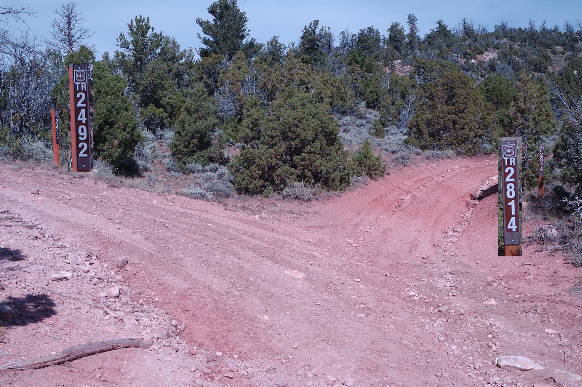
E. Junction #2814 and #2492: Right (#2814) follows west fork rim of Bear Canyon.
F. 4.1 miles: Upper Bear Canyon Overlook. Pick your own spot to stop, maybe for lunch, sit and enjoy the view of much of the south slope of Big Pryor Mountain both above and below you. The highest point on the ridge to the east is the peak of Red Pryor Mountain. The Absarokee and Beartooth Mountains can be seen just over the rise to the west. Depending on the time of year wildflowers may be on display. You may see arrow-leaf balsamroot, sky-blue flax, white sego lilies and more.
Return Hike Options: Turn around wherever you wish and return the way you came. Or follow the loop route (purple) on the map. Note that the 1/4 mile, two-track segment from #2814 to #2492 has had signs missing. (It is officially #24923.). Alternatively simply head east, off-trail about 1/3 mile, from #2814 to #2492 wherever you want. (See red line on map.). The loop alternative provides more views of the Absarokee and Beartooth Mountains to the west.
Bear Canyon Creek Hike (Right fork at junction B above.)
… with optional climb to east Bear Canyon Rim Viewpoint, and loop hike connections with the Big Sky or Rocky Juniper Trails.
B. Junction and barrier at start of Creek Trail.
C. BLM/USFS boundary fence and gate.
Follow the right fork (Junction B), past the jack-leg barrier, into the bottom of the canyon.
The canyon narrows, the vegetation changes becomes noticeably more lush. Cottonwood and ash trees, and clematis vines become abundant. In the spring the creek is often running. It is a great place to look for birds, butterflies, and wildflowers.
Noxious Weeds: Unfortunately there is a significant infestation of invasive weeds in the bottom of Bear Canyon. Be careful not to collect and transport the “Velcro” seeds of houndstongue and burdock beyond their current infestations. Usually you can avoid the plants, but check your clothes frequently and remove any seeds. Carry them out to dispose.
The “trail” is rougher since a 2011 flash flood. At times it simply follows the rocky stream bottom.
C. 1.9 miles: Fence and Gate. About ½ mile past the barricade at junction (B) there is a fence and gate. The fence is the boundary between BLM land to the south and USFS land to the north. North of the gate the canyon enters the USFS designated Bear Canyon Recommended Wilderness. (If there is an "Unauthorized Trail" sign at the gate, it only applies to motor vehicles. Hikers are welcome to continue.)
E. 2.7 miles: Fork in Canyon. 0.8 mile past the USFS boundary fence there is a major fork in Bear Canyon split by a high rocky promontory. The left (west) fork continues north without a trail. The right (main) fork turns to the east for ¾ of a mile, and then turns north again. The trail continues for a little farther, but soon fades into bushwhacking - especially after the 2011 flood. The total elevation gain from the mouth of Bear Canyon to this fork in the Canyon is about 450 ft.
D. A short segment of the lowest switchback is barely visible sloping up and to the right between the two white arrow tips.
D. Google Earth view of Bear Canyon Switchbacks. White arrows parallel trail pointing uphill.
D. 2.3 miles: Alternative trail to East Rim Viewpoint.
0.4 miles past the BLM/USFS boundary gate (C) there is an old trail that switchbacks up the hill to the east canyon rim. There is no trail junction. You must push through brush for a couple hundred feet from the gravel streambed/trail in the canyon bottom to intersect the switchback trail at the base of the slope. Look for the scene in the photo. The trail is not obvious from below, but is obvious when on it. (Photo taken from about GPS coordinates: 45.0923°N, 108.5160° W)
It is about 0.3 mile and 250 ft elevation gain to the rim on a surprisingly good, but little used, trail. The views on the way up, and from the top, are well worth the climb.
Once on top the trail ends, and the open country invites exploration, but be careful not to “lose” the trail back down.
Return the way you came, or consider two loop hike alternatives: The East Rim Viewpoint at the top of the switchbacks is also THE Junction where the Big Sky, Rocky juniper and Bear Canyon Trails converge. You can return via either the Rocky Juniper or Big Sky Trail. See the Hikers’ Haven Loop Hike Guide for details on these loops.